What’s just as important as keeping network diagrams up-to-date? Your cabling infrastructure (we’ve written about cable management and cable software for many years — click here to explore some of those blogs on cabling).
So, what about documenting the fiber plant? Many of our prospective customers ask us how other organizations are managing and mapping fiber today: mostly spreadsheets and Google Earth diagrams? If you’re struggling, you’re not alone. There are many organizations that are looking for a better way to manage the fiber plant.
Why look at other tools? For one, it’s hard to see the fiber strands in Google Earth and you cannot drill into the diagrams further to see the actual fiber strands and its capacity.
In this post, we’ll use netTerrain OSP software (our product), as an example of how fiber mapping software can help. You can click here to learn more about netTerrain OSP and other options for fiber mapping software.
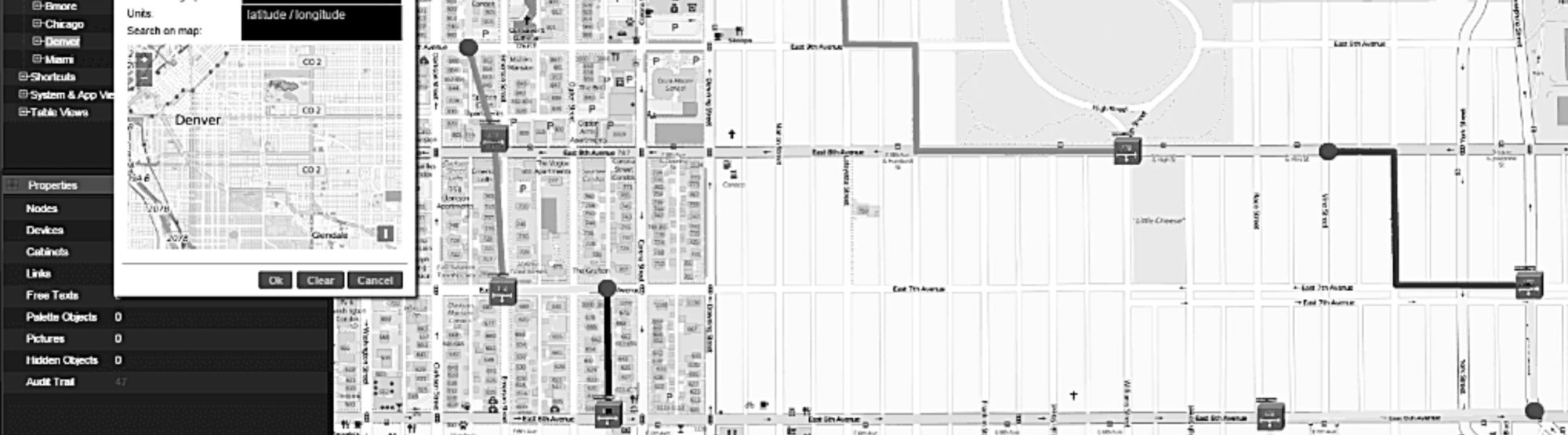
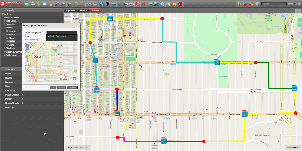 For the sake of example, we’ll discuss our fiber mapping software netTerrain OSP (shown above)
I’ve found that folks often ask the following questions:
Question: Finding Fiber Information?
There is no good way to search for information if its scattered across multiple files, locations, etc. So how can you find information easily?
Answer: With netTerrain OSP, you can have one central place to create, edit, and view your fiber plant diagrams, making searching a breeze. You can also attach documents, pictures to any object in netTerrain.
Question: What Can I Visualize?
Are there other ways to see data center rooms, telecom rooms, office space, and the fiber and its strands outside the buildings, such as manholes, handholes, towers, antennas in one application?
Answer: netTerrain doesn’t have any limitations on what you can create. Place any number of sites, buildings, rooms, floors, and street level views of your cabling, all done through a standard web browser.
Question: How Can I Manage Fiber?
How can I manage fiber capacity more effectively, such as reserving strands, creating work orders that you can print/send to staff or contractors, or the ability to find available fiber path between two buildings? Does netTerrain also have an automated fiber routing that finds vacant fibers?
Answer: Manage your fiber visually and see each buffer tube color and its strands to manage capacity and run reports on fiber strands used/reserved/available.
You can also manage fiber strands and how they are connected with netTerrain’s Circuit Layout Record (CLR). The CLR provides the ability to view each leg the entire physical and logical hierarchy starting at virtual channel, port, card, device and up to the site level. netTerrain’s Automated Circuit Routing Algorithm (ACRA) determines optimal routes between two buildings on a map and creates a new circuit in netTerrain, and its path it should take. Learn more about working with cables and strands by clicking here.
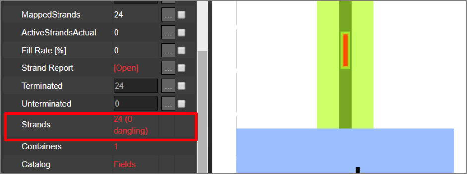 Fiber strands displayed within netTerrain
Question: Can I Import and Export My Diagrams?
Can I import Google Earth diagrams as well as export netTerrain diagrams back to Google Earth? What about creating Bill of Material reports to help with price quotes or send it to a colleague for reference?
Answer: netTerrain uses Open Street Maps (OSM) as its dynamic web-based maps. These maps are updated frequently, and most often shows buildings, and streets. You can import your Google Earth diagrams and netTerrain provides many ways to export diagrams including: PDF, Visio, and Google Earth. You can easily supply these diagrams to your staff, customer, contractors, along with Bill of Material reports. Learn more about importing diagrams by clicking here.
To sum up, documenting the fiber plant is just as important as your inside plant’s infrastructure. If you’re not happy with what you’re currently using (or not using), you’re not alone. Many organizations select netTerrain OSP as their fiber mapping software so that they can stop fighting with Google Earth and spreadsheets, know what they have, where it is, and how to fix it, plan for capacity….and stop worrying about backhoes and cut wires.
Want to learn more about netTerrain OSP? If you would like to see videos of netTerrain and how it can be used to manage not only your Outside Plant elements, as well as your Inside Plant, we have posted many netTerrain Outside Plant videos (11!) on our YouTube channel: to view our OSP playlist, click here. To schedule a demo and to receive an online trial to see if netTerrain would be a good fit for your organization, please feel free to call us at 240-912-6223 or just fill out this request form here. We also have upcoming webinars that you can register, view, and ask questions by clicking here.