Here at Graphical Networks, we often say that our fiber mapping software solution (netTerrain OSP) helps fiber technicians and managers get their jobs done faster, easier, and more successfully. What, exactly, is it?
Fiber Mapping Software: What Is It?
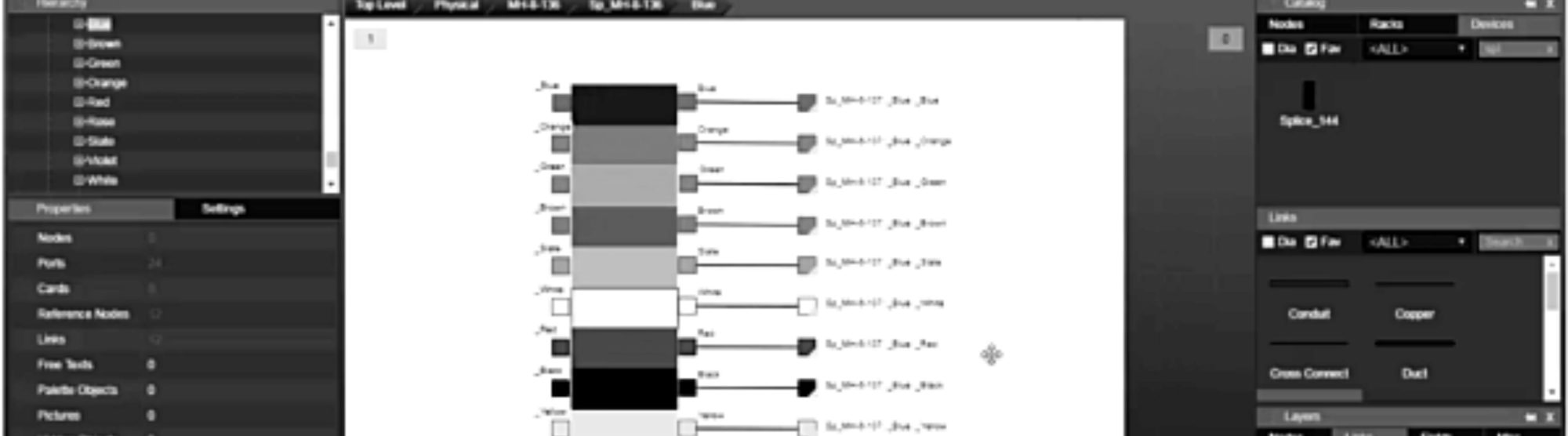
Fiber mapping software, such as netTerrain OSP, gives those managing or working on fiber the visibility they need to answer specific questions about the infrastructure. With it, you can track distances, understand fiber capacity, know where a problem occurs and how to fix it, and visualize everything from fiber splices to manholes to GIS-enabled street views. You can even drill down to the fiber patch panels inside of buildings.
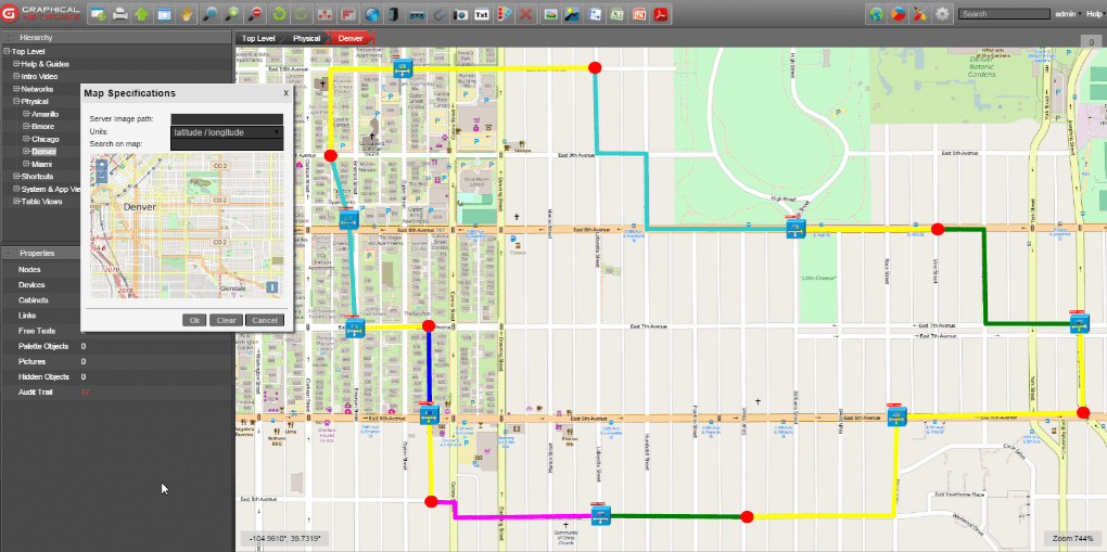 Example: street-level view in netTerrain OSP fiber mapping software
How Fiber Mapping Software Helps
Stop Worrying About Backhoes
Before netTerrain OSP, many of our customers were struggling to keep up with the network and tracking fiber changes. Things that kept them up at night? Backhoes….yes, really. Backhoes and cut wires (click here to read more on why you may need OSP software). Fiber that’s outside of the plant is vulnerable to accidents. When something gets knocked out, how can you track what happened, and what else is impacted, without fiber mapping software such as netTerrain OSP.
Escape Spreadsheets and Visio
Before switching to fiber mapping software, technicians and managers often find themselves trying to fit square pegs into round holes. How? Using spreadsheets, Visio, CAD, and Google Earth to track connectivity and outside plant assets. Because these tools aren’t made for the task at hand, it creates an impossible task: the result is substantial amounts of time lost, data that’s collected in multiple sources but can’t be unified in a usable way, and wasted money.
If you have existing data already, such as in Visio or spreadsheets, or Google Earth, you can bring that in to netTerrain in a few clicks — for example, netTerrain supports KML and KMZ imports.
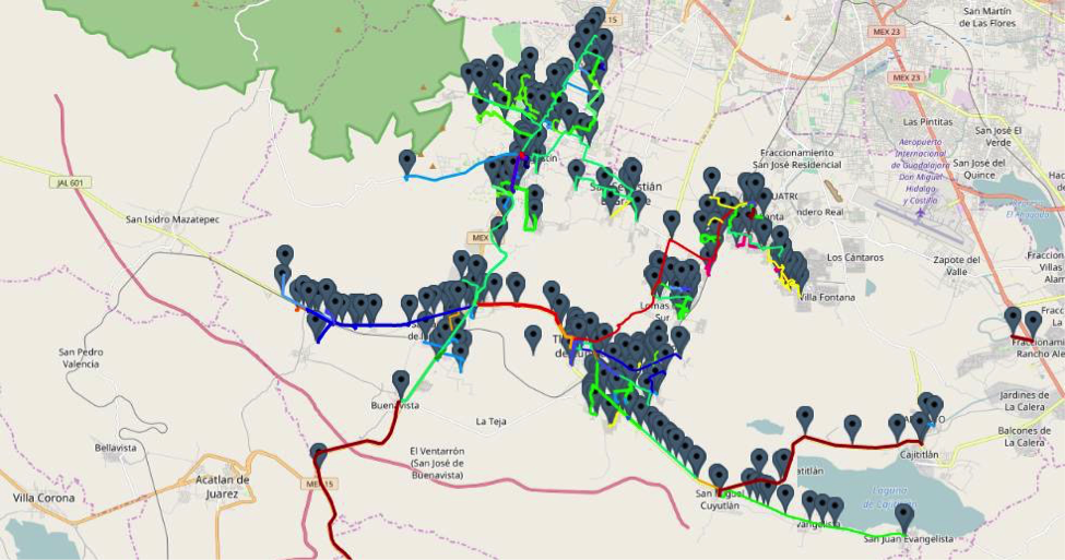 Example: import KML and KMZ files into netTerrain OSP fiber mapping software
End Wild Goose Chases
When you can visualize your fiber network, you can understand it. Instead of sending people out to the wrong location, fiber mapping software helps you to pinpoint where an issue has occurred so that you can respond quickly and accurately. Sending techs, or contractors, out into the field every time you need to get a question answered is costly and time-consuming. With fiber mapping software such as netTerrain OSP, however, you can keep all of your knowledge in one easy-to-access place.
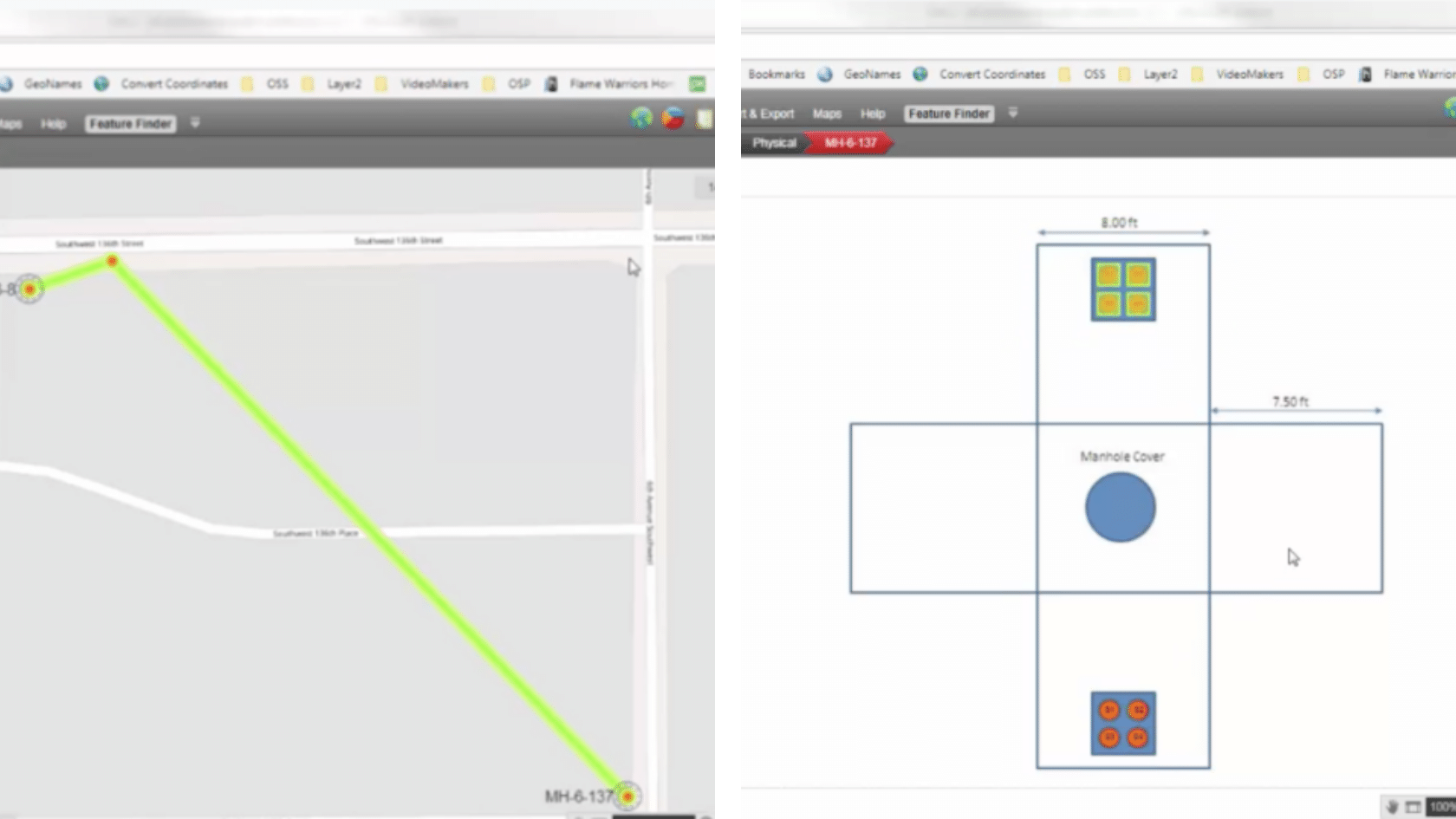 Example: manholes visualized with netTerrain OSP fiber mapping software
Understand Your Capacity
When you need to know if you have strands available, how do you get your question answered? If you find your team jumping into manholes to figure it out, fiber mapping software is a game-changer. Stop wasting time having to physically investigate something every time you need to know something about your fiber infrastructure.
Manage Your Inside Plant, Too
If you need to manage what’s going on in your inside plant, fiber mapping software such as netTerrain OSP can help with that, as well. You can track your outside cables, and also see how they run and connect inside of your plant. Inside and outside plant connect together — software should be able to provide a unified visualization of all of it. With netTerrain OSP, you can drill down from the globe and street to the port level and fiber patches inside your buildings.
There are many more benefits to fiber mapping software — and we’ve written about many of them on our blog (click here to explore more articles on fiber mapping). Our fiber mapping software netTerrain OSP (outside plant) is so focused on helping our customers do their daily work that the idea for it actually came from our existing customers, who were already using netTerrain for network documentation and DCIM, asked us to add on fiber mapping and outside plant capabilities.
If you’d like to see netTerrain in action, you can request a demo here. If you’re just interested in learning more about fiber mapping software options, this blog is a great place to start.