
Cities Have a Fiber Problem. It Starts Before Anything Breaks.
A city can own miles of fiber and still struggle to answer a basic question: What do we have, where is it, and what’s available?
It isn’t only a mapping problem.
It’s an infrastructure-management problem.
The National Telecommunications and Information Administration (NTIA) has identified a larger challenge for state and local governments: infrastructure information can be scattered across organizations and databases, incomplete, outdated or difficult to use.
Its guidance points toward a deceptively simple idea: create a centralized record of the infrastructure you already have.
Because you can’t efficiently plan, expand or protect infrastructure you can’t clearly see.
One Municipal RFI Shows the Pattern
We recently reviewed an RFI from a U.S. city looking for a better way to manage its fiber infrastructure.
The city’s name isn’t important. The problem is.
There was no single system of record for the fiber network.
Information was spread across departmental applications and documents. Fiber and conduit weren’t consistently treated as separate assets. Strand-level and geographic information had gaps. Field staff couldn’t reliably access or update what they needed.
Where infrastructure intersected with neighboring or overlapping agencies, ownership and maintenance responsibilities could also be unclear.
None of those problems sounds catastrophic on its own.
Together, they create a chain.
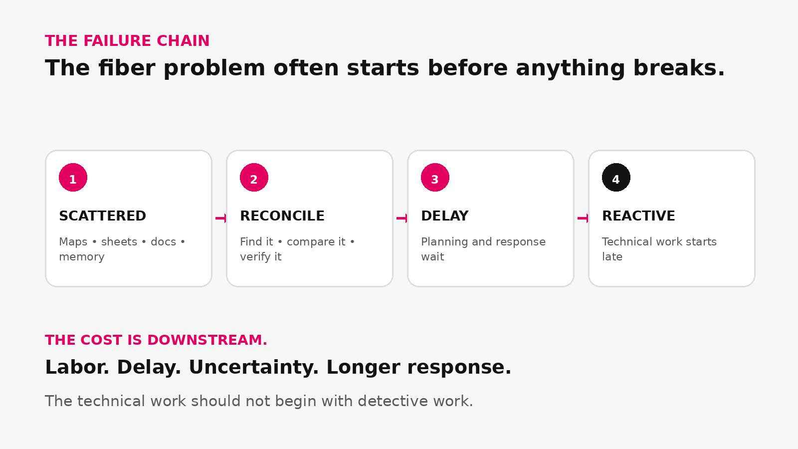
When the network record is fragmented, the cost shows up downstream.
The Technical Work Starts With Detective Work
A new service request starts with finding the records. A capacity question starts with reconciling them. A construction project starts with confirming what’s actually there.
And when an outage happens, the team may have to reconstruct the affected path before troubleshooting can fully begin.
The technical work starts with detective work.
That’s where a documentation problem becomes an operational problem.
- Projects wait while teams gather data.
- Staff time goes to searching and verifying instead of doing.
- Existing capacity becomes harder to use confidently.
- Troubleshooting starts later than it should.
And if the most reliable record of the network is the person who remembers how everything was built, institutional knowledge itself has become infrastructure.
A Map Is Only Part of the Answer
Most cities already have maps.
The question is whether those maps can answer operational fiber questions.
A geographic line can tell you where a cable runs.
But infrastructure teams often need to know much more:
- Which conduit?
- Which cable?
- Which strands?
- Which splice?
- Which circuit?
- What capacity is still available?
We’ve written before about the difference between traditional GIS and dedicated OSP/fiber management software. GIS provides essential geographic context. OSP documentation adds the physical-layer connectivity and detail needed to understand what’s actually happening inside the network.
And if answering those questions means bouncing between Google Earth, spreadsheets, diagrams and other records, that problem isn’t new. Organizations have been outgrowing Google Earth and spreadsheet-based fiber documentation for years.
The tools change.
The underlying problem doesn’t.
Where the Chain Can Be Broken
The answer isn’t simply a prettier map.
It’s a dependable system of record for the physical network.
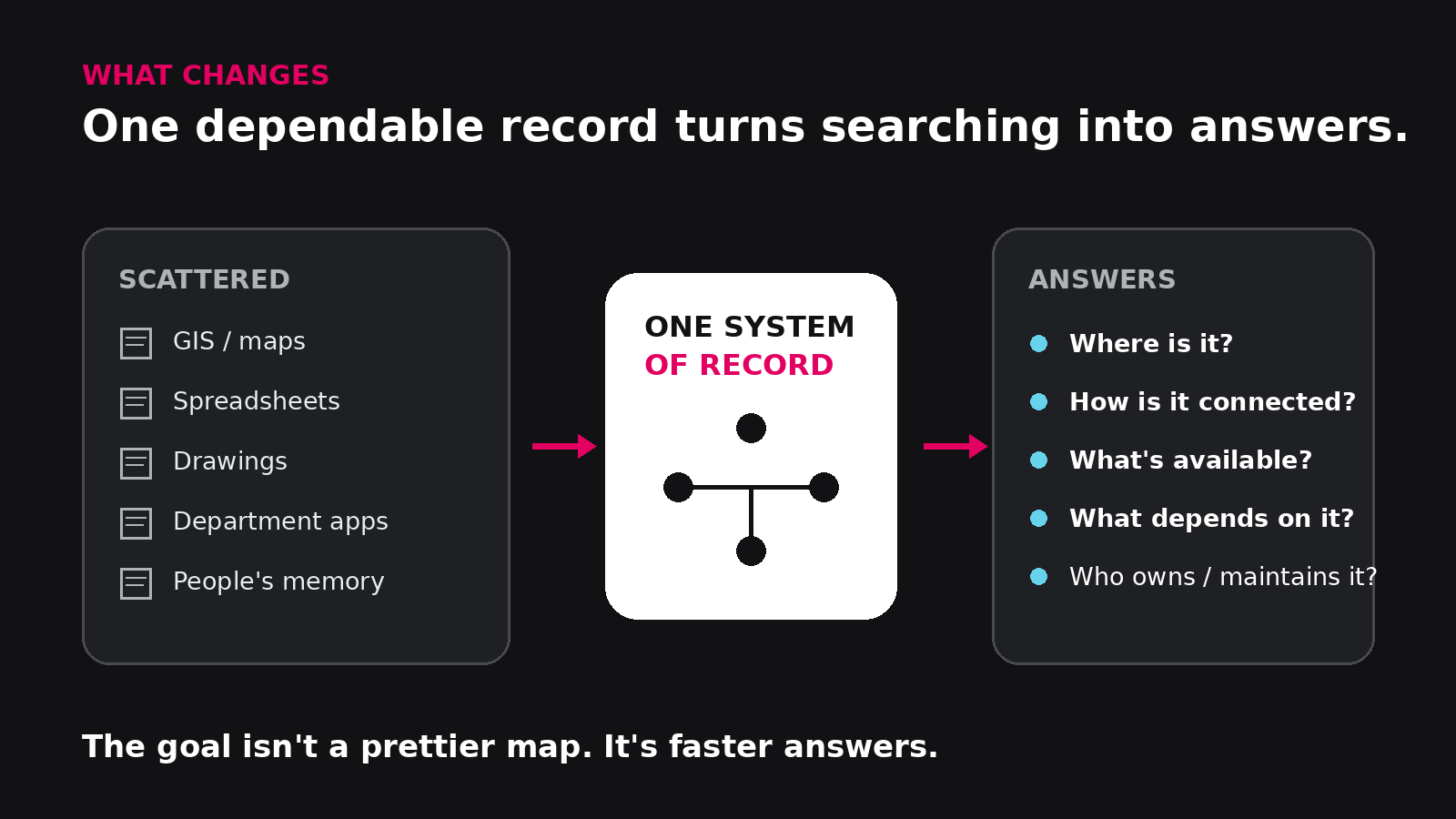
The goal isn’t another place to store information. It’s a dependable place to get answers.
A useful fiber record should be able to answer:
- What do we have?
- Where is it?
- How is it connected?
- What’s available?
- What depends on it?
For fiber infrastructure, that means being able to move from the citywide view into the physical network itself: routes, conduit, manholes, cables, splices, strands, circuits and endpoints.
It also means knowing not merely that fiber exists, but how it’s being used and where capacity remains. Our practical guide to documenting fiber networks goes deeper into what cities, campuses and utilities actually need to capture.
If you’d rather see the mechanics, Jan’s fiber strand and splice-box walkthrough shows how strand-level documentation works in netTerrain OSP and includes the accompanying video.
The goal isn’t another repository. It’s faster answers.
One City Already Made the Shift
The City of Seguin, Texas faced a familiar challenge: fiber records spread across spreadsheets, paper drawings and Visio files.
By implementing netTerrain, the city created a centralized view of its aerial and underground infrastructure, allowing staff to plan expansions, locate assets and better understand strand-level connectivity.
The biggest improvement wasn’t a better map. It was having information that could be trusted and used.
Read the City of Seguin case study →
That’s the Real Job of OSP Software
netTerrain OSP gives teams a central place to document and understand the physical fiber network from street to strand.
Routes. Conduit. Manholes. Cables. Splices. Strands. Circuits. Capacity. Connections.
Existing information can come with you, too. netTerrain supports bringing in existing data such as spreadsheets and KML/KMZ files rather than forcing a city to start again from zero.
But the objective is simpler than the feature list.
The next time someone asks:
- Where does this fiber go?
- Do we have capacity?
- What does this connect to?
- What happens if this path goes down?
The answer should already exist.
Ready to Create a Single Source of Truth for Your Fiber Network?
If answering basic questions about your fiber network still requires searching through spreadsheets, drawings, disconnected systems or individual employees’ memories, it may be time to establish a true system of record for your outside plant infrastructure.
Learn how netTerrain OSP helps cities document, manage and understand fiber networks from street to strand.
“`