
In the last post, we went over the basic structure of netTerrain and looked at the top questions asked about netTerrain Logical, for network diagrams and automated network documentation. Next, let’s look at netTerrain OSP (Outside Plant).
What is it?
netTerrain OSP is an ideal solution to document all of your fiber cabling infrastructure — from documenting and managing fiber conduits, duct banks, fiber strands and as well as copper for inside the buildings. netTerrain OSP is offered on a Cloud platform or an on-premise version (netTerrain OSP is an add-on module which you can add to either netTerrain Logical or netTerrain DCIM — you can read more about netTerrain add-on modules here).
Question:
Which do I need…netTerrain Logical or DCIM with my OSP module?
As netTerrain OSP is an add-on module for either netTerrain DCIM or netTerrain Logical, you need to select which type of netTerrain is right for your organization’s needs.
Deciding this is pretty simple: what do you need to document?
If you want to document inside the buildings and have lots of racks that needs to be documented, then you will need to go with netTerrain DCIM. Customers that have data centers, telecom rooms that needs to show patch panel in racks, utilize the dashboard reports, and work order tasks, will also want to have netTerrain DCIM with the OSP module.
For documenting connections and documenting manholes, handholes, fiber enclosures, splitters, and showing the fiber cable terminate inside a room or a patch panel, and not inside a rack, or have a small amount of racks, or not focused on Inside Plant, then netTerrain Logical is needed as the base for your OSP module.
Question:
Can I import ESRI files, AutoCAD, Google Earth (KMZ.KML) diagrams?
Yes: you can import your KMZ/KML files right into netTerrain (read more about it here). As for AutoCAD, you will need to convert these diagrams into a JPG image, as netTerrain diagrams are all viewed with a standard web browser. There are many free converters out there to convert from .DWG to .JPG. For users that have Shapefiles from ESRI, at this time, netTerrain does not support an import from an ESRI Shapefile.
Question:
Does netTerrain OSP have its own GIS Maps?
Yes, netTerrain utilizes OpenStreetMaps (OSM) for its GIS Maps. It has six decimal lat/long coordinates — with the ability to zoom down all the way to a street view. Most of the maps has the outlines of buildings in OpenStreetMaps.
If there is a building not there, you can either request it to be added in OpenStreetMap.org or just add a building from the netTerrain Catalog and place it on the diagram. For example, here is a picture of our office building complex!
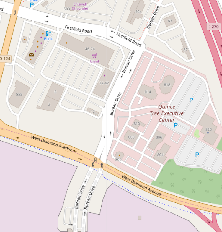 Our Office Building Complex, in netTerrain
With the street views, you can place your manholes, handholes, and draw out your conduits, all following the streets.
Question:
Can netTerrain OSP show me available fiber paths between selected buildings?
Yes — it can! With its Automated Circuit Routing Algorithm (ACRA) feature, netTerrain determines the routes that are vacant between two points on the diagrams. It also allows you to create a new circuit — and the path it should take.
Question:
I have almost everything in spreadsheets. Can I import the spreadsheet into netTerrain and have it populated netTerrain diagrams?
Yes! You can build the entire project by using your existing spreadsheets. If your spreadsheet has lat/long coordinates, the items will be placed exactly where the coordinates are. You’ll just need to tweak the spreadsheet to create the hierarchical relationships, which we can show you with a video tutorial.
Question:
If netTerrain is web-based, can I use netTerrain OSP (and its maps) without any internet connections?
In a typical use case, if you use netTerrain with an on-premise license, the client machine needs to have a connection to the internet. If this is a problem in your environment, however, you can create your own internal OSM server.
To sum up, the above are the top most commonly asked questions about netTerrain OSP, our outside plant add-on module for netTerrain. If you have more questions, you can requesta demo/15 minute discovery call here, shoot us an email here or give us a call at +1-240-912-6223.
In the next post in this series, we’ll discuss netTerrain DCIM (for Data Center Infrastructure Management).
Stay tuned!