During the intervening years since we first launched netTerrain Outside Plant (OSP) — it’s an add on module to netTerrain Logical or netTerrain DCIM — we’ve fielded many questions about the type of GIS-enabled maps that netTerrain supports as well as netTerrain’s ability to import existing maps/diagrams.
What’s netTerrain OSP (Outside Plant Software)?
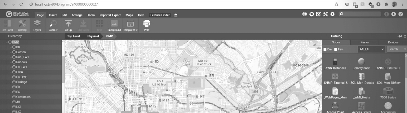
First, what’s netTerrain OSP? It’s fiber plant and outside plant diagram software that help you navigate from a bird’s eye to a worm’s eye view of your sites to cities, to campus, streets, buildings, all the way down to splice boxes and fiber strands. netTerrain’s maps are GIS-enabled and dynamic maps that provide 6 decimal precision for exact positioning along with 19 zoom levels and map layers. You can place literally any element on these maps, from fiber ducts, manholes, and fiber conduits to towers, poles, antennas, and buildings.
In netTerrain, it’s easy to drill down from the building to its floors and rooms to document your inside plant cabling, including your office floors (workstations, printers, to wall jacks), telecom room, and data center floors with cabling inside the cabinets/racks.
Which GIS Maps Does Our Outside Plant Software Use?
So, let’s get down to business! For organizations looking to use GIS maps to map your Outside Plant infrastructure, from buildings, to manholes, poles, and the fiber pathways and conduits: what map does netTerrain OSP use?
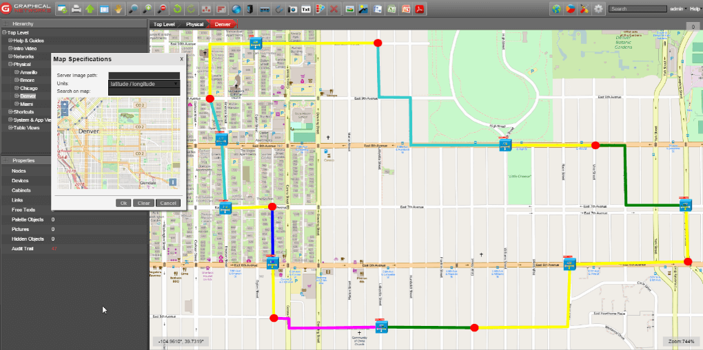
netTerrain uses OpenStreetMaps for its GIS-enabled maps. If you haven’t heard of OpenStreetMaps, navigate over to the OpenStreetMap website and find your address/campus to check out how it will look in netTerrain.
Our customers really appreciate that OpenStreetMaps are completely up-to-date and accurate. I have a lot of meetings with different university IT teams, and, in one recent meeting, the team really couldn’t believe just how current and accurate the diagrams were. If something is, for some reason, not current, that’s easy to fix: you create an account with OpenStreetMaps (OSM), you can make your own changes and add new buildings in OSM. Your changes are reflected very quickly — so you’ll always have up-to-date maps in netTerrain!
Does netTerrain Offer Satellite/Terrain Views?
netTerrain OSP does not have satellite/terrain views, so if you need these types of maps, netTerrain is not a good fit for you. However, if you have created fiber plant diagrams in Google Earth, you can import them into netTerrain! netTerrain has a built-in import/export feature to/from KML/KMZ diagrams. netTerrain does not have an integration to ESRI Shapefiles, so you will need to convert them from shapefile to KML, then you can import the diagrams into netTerrain.
What If I Want to Use My Own Maps?
If you’ve read our case study with the University Notre Dame team, you already know this: you can eschew the built-in OpenStreetMaps and upload your own maps and diagrams to use. In the case of Notre Dame, they had detailed maps that just showed a higher level of detail. Uploading these maps took seconds, and if you want to upload your own maps to netTerrain, it’s basically effortless to do so. If you want to take a look at the case study, just click here to read it.
For more information about netTerrain OSP, I just recently wrote an article here: or visit our product page here. Ready to see netTerrain OSP in action? Click here to set up a time for a quick conversation.