
In a previous blog, we discussed how a couple of customers had developed their own mobile apps for netTerrain DCIM.
One of these customers, Acciona Energía (a global renewable energy provider from Pamplona, Spain) presented their results at our annual users summit (the summit took place between May 13th and 15th at the Bolger Center in Bethesda, MD).
Using netTerrain’s REST API, they developed a mobile app, that is portable to all major operating systems, in which a user can scan devices that have been tagged with an RF code. They can also find that device (or any other searchable item) automatically in netTerrain, look up the location information, predefined and custom properties, and even create a list view of the end-to-end connectivity.
This is all accomplished through using their smartphones.
As mentioned in the previous blog, it was a moment of pride for us — not because building something like is necessarily rocket science but because it was done in a short period of time with just the basic API (which we make available for all of our customers).
Seeing this work done made us realize we had just empowered a customer to go above and beyond the standard usage of the tool simply by opening up the platform with an extensible, easy-to-use and well documented API.
The App
After logging in (simply by using the same credentials that the netTerrain server later validates), a user is presented with a basic screen showing the two main features: scanning and searching. There is also an information page to access the version of the app.
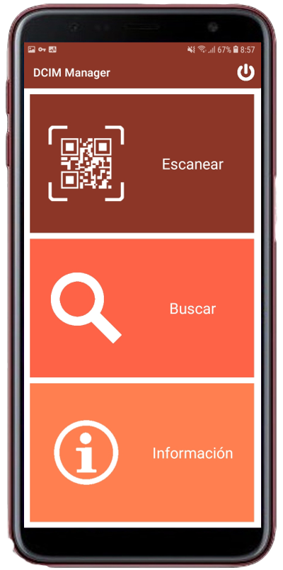 Main screen view
Devices are tagged with an RF code (generated from the unique 14 digit netTerrain ID); RF tags could really use anything, such as an IP address, a DNS name or any property. Using the netTerrain DCIM internal IDs ensures that each item search will retrieve one, and only one, record since these 14-digit decimals are unique throughout the whole configuration management database.
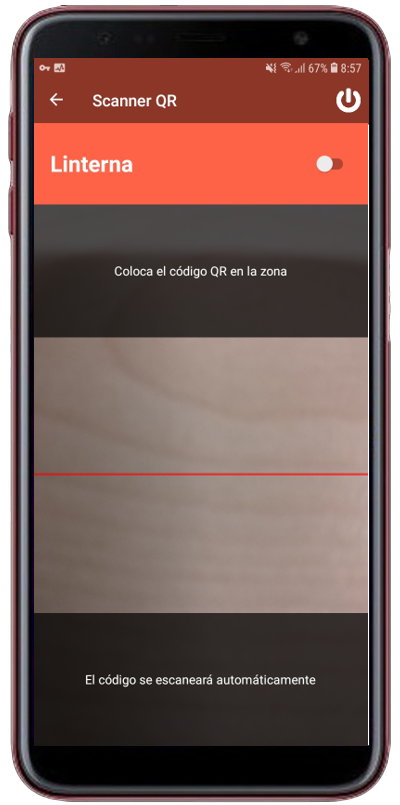 Scanner function
From the smartphone, as shown in the image above, users can then proceed to scan a device. The scanning process returns a confirmation of that unique 14-digit code to acknowledge that the record has been found. The scanning process will redirect the user to the properties view of the device that was found, as shown below:
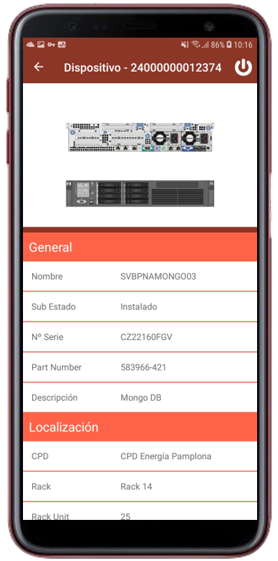 Device properties
Predefined and custom properties can be displayed on the mobile app. You can also categorize properties, such as the ones related by location, and put them in an order different from the default order in the netTerrain web app (although we do not necessarily recommend doing so).
If a device has cards/slots or ports, these can also be accessed from the interface, including the status of the ports, which are discovered using netTerrain’s native SNMP discovery that was used to map the network.
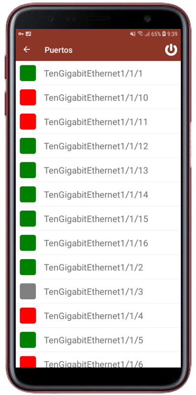 Ports view
For virtualized environments (such as an ESX blade server), showing cards (each representing a VM host for example) can come in handy. Each row in the picture below is one such host, which can also contain a list of all the virtual machines underneath it.
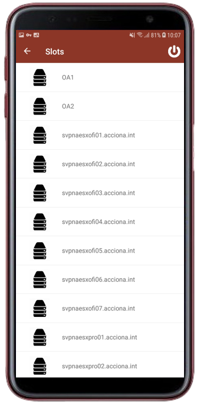 Virtual machines on blades
A search function is also available — in two modes:
- Basic search: in which the user can input a string and obtain results akin to the quick search in the netTerrain web app
- Advanced search: with parameters that the user can input
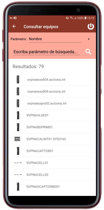 Search on mobile app
Because it is important for users in the data center to obtain as much information as possible about a server they are looking at on a rack, right there on the spot, the mobile app also lets users launch a circuit layout record (CLR) and a list of all the attachments a device has.
The circuit layout record provides a tabular view similar to the graphical circuit layout record that you may know from netTerrain. In this table, users can see the end-to-end cable connectivity (copper or fiber), ideal for cable management tasks related to commissioning or decommissioning ports and devices.
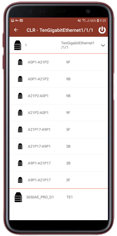 CLR view
Finally, the document view gives users the chance to download any documents attached to a resource, such as a config file for a router, right from a smartphone.
Roadmap
While this app serves as an excellent example of how powerful the netTerrain API can be to even create your own mobile app, here at Graphical Networks we are developing an extended version that will also provide map views for outside plant users. This is still in the roadmap, so stay tuned for announcements!
In sum, we will be continuing this discussion to bring you more on what Acciona has accomplished as well as what our other customers have been up to.
Afterall, empowering our customers by providing robust and flexible software, such as
netTerrain DCIM, that works for our customers in the way they need it to, and not by forcing our customers to work around our software, is our greatest goal.